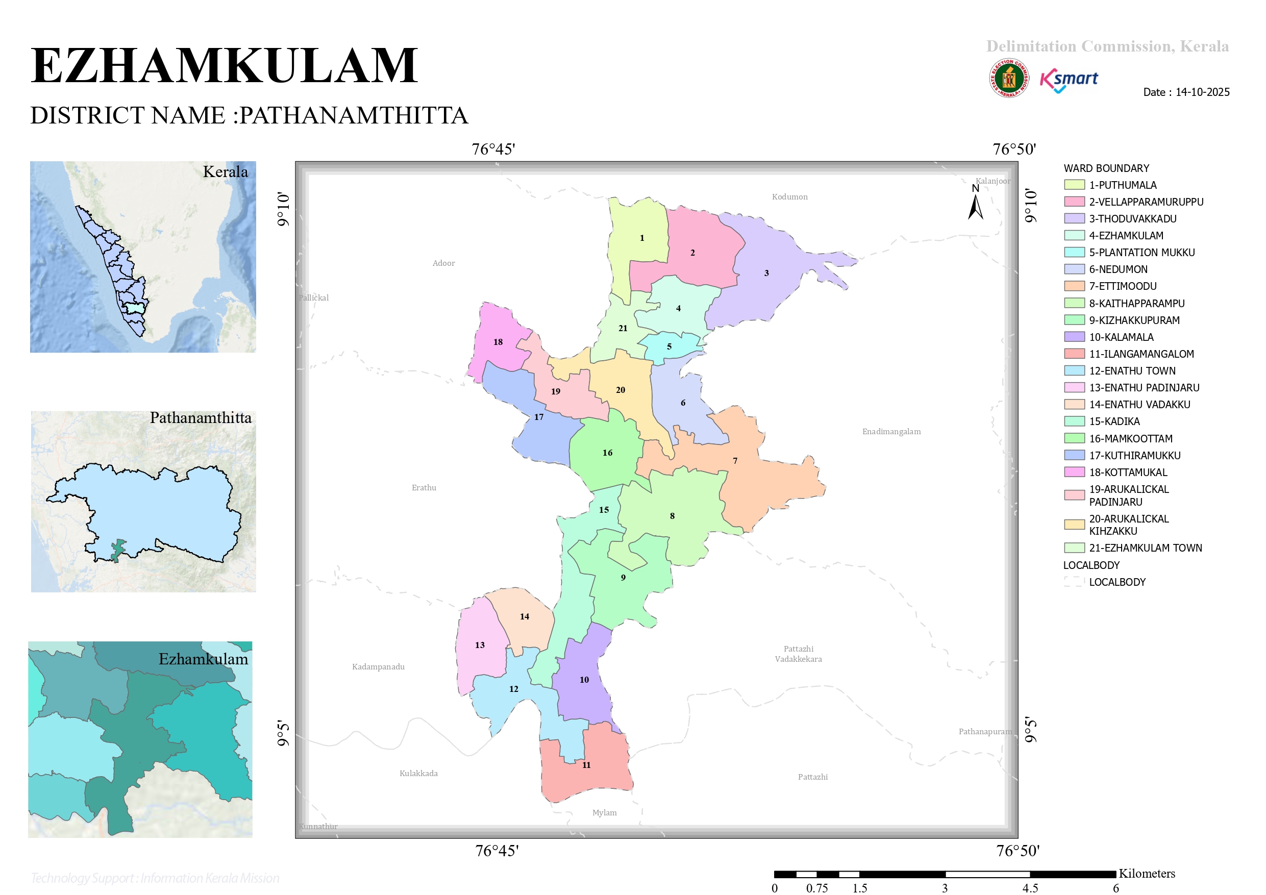
Map 2026
2025 Ward Delimitaion Map Regarding
This is the official GIS-based interactive ward map of Ezhamkulam Gram Panchayat, prepared as part of the 2025 Ward Delimitation process for Local Self-Government Institutions in Kerala. The digital map enables the public to understand ward boundaries and explore location-specific information with ease.
Based on the notification issued by the Government of Kerala, 21 electoral wards have been constituted in Ezhamkulam Gram Panchayat. The final delimitation order was issued after considering the objections and suggestions received from the public following the publication of the draft proposals.
The Final Order of the Delimitation Commissioner and the Official Final Ward Map are available here for reference.
Interactive Ward Map
Official GIS-Based Ward Map of the Gram Panchayat
Ward Boundary Details
Clearly displays the updated ward boundaries prepared in accordance with the 2025 Ward Delimitation.
Interactive Navigation
The map provides features such as zooming, exploring different areas, and locating places.
GIS Technology
GIS technology has been used to provide accurate geospatial information